Finding a family-friendly neighbourhood in Birmingham requires evaluating local primary schools, overall area safety, green spaces, and property prices across the West Midlands metropolitan county.
- What Factors Define a Family-Friendly Neighbourhood in Birmingham?
- Why Is Sutton Coldfield Considered a Top Choice for Families?
- How Does Harborne Offer the Ideal Suburban Lifestyle for Parents?
- What Makes Bournville a Unique Historic Garden Village for Children?
- Is Edgbaston Suitable for Families Seeking Elite Schools and Space?
- How Do Moseley and Kings Heath Compare for Family Community Life?
- What is the safest neighbourhood in Birmingham for young families?
- Are state schools in Birmingham good enough compared to private options?
- How far is the commute from Sutton Coldfield to central Birmingham?
- What is the average house price for a family home in South Birmingham?
- Which Birmingham suburb offers the best balance of parks and high street shops?
Selecting an area demands analyzing Ofsted inspection ratings, local transport links, housing stock types, and community infrastructure to secure a suitable home environment.
Birmingham is the second-largest city in the United Kingdom, located in the West Midlands region. Urban expansion during the Industrial Revolution transformed the area from a market town into a major manufacturing hub. Metropolitan restructuring in 1974 integrated suburban districts into the modern Birmingham City Council authority, creating distinct residential sub-markets with unique housing architecture.
Evaluating family suitability involves examining four key structural components across local districts. Educational infrastructure includes state primary schools, grammar schools, and nursery provisions rated by Ofsted.
Safety infrastructure comprises local neighbourhood policing teams and ward-level crime statistics published by West Midlands Police. Park space includes 8000 acres of public green space, nature reserves, and play areas. Housing stock encompasses Victorian terraces, semi-detached houses, and modern detached family homes.
The process of locating an ideal district follows five systematic steps. Homebuyers define budget parameters based on local property data. Families cross-reference school catchment maps provided by Birmingham City Council.
Purchasers analyze crime statistics using official police databases. Parents visit local parks and retail corridors to assess community infrastructure. Buyers finalize mortgage agreements and complete legal searches through conveyancing solicitors.
Suburban developments across the city illustrate varying family environments. Harborne features Victorian housing stock near Queen Elizabeth Hospital. Sutton Coldfield offers suburban living adjacent to Sutton Park.
Bournville provides historic garden village housing established by the Cadbury family. Edgbaston features large period properties near elite independent schools. Solihull offers border residential options within the wider West Midlands conurbation.
According to data from the Office for National Statistics published in 2026, the average house price in Birmingham is £235000, with semi-detached properties averaging £276000 and detached homes averaging £444000. Data shows private monthly rents average £1106 across the city, with three-bedroom homes averaging £1141. Department for Education statistics show Birmingham contains 88 primary and secondary schools rated Outstanding by Ofsted inspectors.
Selecting an appropriate neighbourhood determines long-term financial stability, access to quality state education, and everyday quality of life for growing households. Settling near reliable West Midlands Trains railway stations reduces commuting stress to Birmingham New Street station. Choosing locations with high-performing secondary school options ensures continuity in children’s education without requiring suburban relocation later.
What Factors Define a Family-Friendly Neighbourhood in Birmingham?
A family-friendly neighbourhood in Birmingham is defined by high Ofsted school ratings, low crime rates, abundant parkland, reliable public transport, and supportive community facilities.
Families prioritize locations offering strong primary school catchments, safe streets, accessible healthcare services, and dedicated play areas for children.
Urban planners and property analysts define family suitability using specific socio-economic metrics. Educational provision forms the baseline requirement, where access to state schools inspected by Ofsted dictates local property demand. Public safety metrics measured by West Midlands Police show lower incident numbers in outer suburban wards. Green space availability relies on access to public parks, playing fields, and municipal reserves. Residential infrastructure includes doctor surgeries, dental clinics, local libraries, and community centres.
Evaluating these factors involves systematic research across public domain databases. Parents examine Department for Education performance tables to check primary school key stage two results.
Buyers analyze the UK Police API database to evaluate monthly crime trends across specific postcode sectors.
Transportation assessments evaluate distance to West Midlands Rail stations and National Express West Midlands bus routes. Property evaluations compare price-per-square-metre metrics against city averages reported by HM Land Registry.
Specific areas illustrate how these defining factors combine in real-world settings. Harborne provides access to Harborne Primary School alongside the 15-acre Harborne Walkway.
Bournville incorporates restrictive housing covenants managed by the Bournville Village Trust to preserve green parks and open spaces. Sutton Coldfield integrates extensive retail amenities along Gracechurch Centre with direct access to 2400 acres of protected nature reserve at Sutton Park.
Recent data from HM Land Registry and the Department for Education highlights key infrastructure benchmarks. Wards with top-tier family ratings contain an average of two Outstanding primary schools per postcode district.
Properties situated within 500 metres of high-performing primary schools command a price premium of 8 percent compared to regional averages. Park accessibility metrics show 86 percent of suburban Birmingham residents live within a ten-minute walk of a public green space.
Understanding these criteria prevents costly relocation decisions and optimizes long-term investment. Identifying neighbourhoods that meet educational and safety criteria ensures stable property value appreciation over decade-long holding periods. Families secure access to community networks that support child development while maintaining efficient travel connections to central employment hubs.
Why Is Sutton Coldfield Considered a Top Choice for Families?
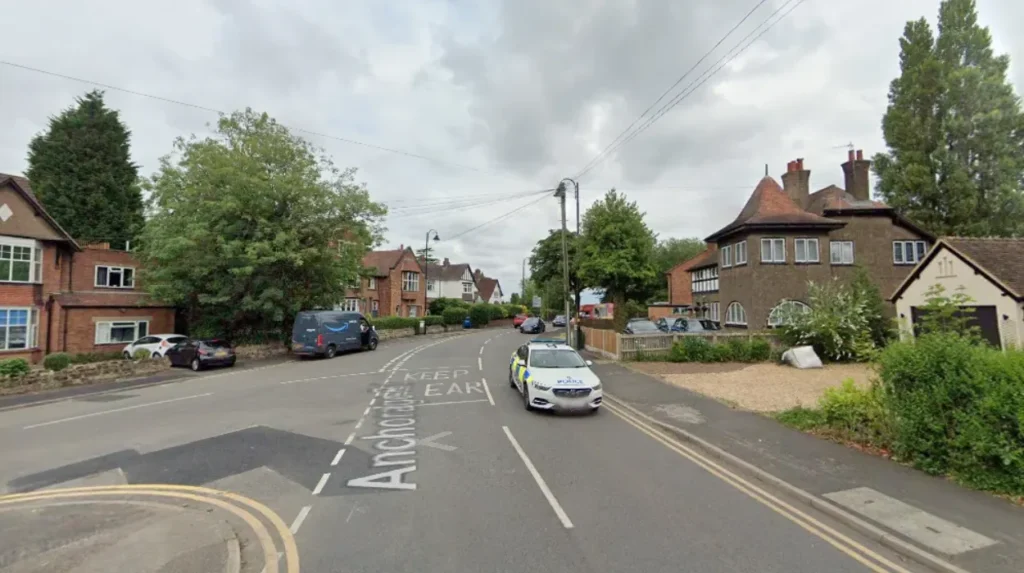
Sutton Coldfield is a top choice for families due to its exceptional grammar schools, low local crime rate, expansive parkland, and semi-rural suburban character.
Located in North Birmingham, the town provides premium detached housing, outstanding transportation connections, and extensive community amenities.
Sutton Coldfield is a historic royal town situated eight miles northeast of Birmingham city centre. Incorporated into the city boundary in 1974, the area maintains its own town council and distinct identity. The housing stock consists primarily of 1930s semi-detached properties, large 1960s family houses, and modern executive detached residences situated along private avenues.
The town operates through specialized local infrastructure designed for residential stability. Education relies on high-performing state institutions, including Bishop Vesey’s Grammar School and Sutton Coldfield Grammar School for Girls.
Healthcare services centre around Good Hope Hospital, managed by University Hospitals Birmingham NHS Foundation Trust. Retail activity flows through the town centre, supported by local commercial hubs in Boldmere, Four Oaks, and Wylde Green.
Families moving to Sutton Coldfield navigate clear operational steps during relocation. Buyers target specific postcodes such as B74 or B75 based on preferred school catchment boundaries.
Parents register applications through the Birmingham City Council admissions portal for primary placement. Commuters utilize West Midlands Railway services from Sutton Coldfield, Four Oaks, or Wylde Green stations for 20-minute train journeys into Birmingham New Street.
Real-world examples within Sutton Coldfield include Four Oaks, Boldmere, and Walmley. Four Oaks features substantial detached homes near the prestigious Estate Private Road network.
Boldmere offers traditional semi-detached housing with a bustling high street containing independent shops. Walmley provides modern family housing developments situated close to Minworth Green and local primary schools.
Property market data from HM Land Registry indicates average property prices in Sutton Coldfield stand at £380000. Detached properties in Four Oaks average £650000, while semi-detached homes in Boldmere average £320000. Sutton Park covers 2400 acres, providing national nature reserve status, seven lakes, and extensive playing fields for local residents.
Choosing Sutton Coldfield guarantees access to prestigious educational pathways and outdoor recreational space. The combination of grammar school options and suburban housing preserves property values during economic downturns. Families gain long-term residential security in an area designed specifically for suburban child-rearing.
How Does Harborne Offer the Ideal Suburban Lifestyle for Parents?
Harborne offers an ideal suburban lifestyle by combining a vibrant independent high street, excellent primary schools, period family homes, and proximity to major hospitals.
Situated three miles southwest of central Birmingham, it delivers a village feel with quick urban access.
Harborne developed as an agricultural village before transforming into an affluent Victorian suburb following the expansion of Birmingham manufacturing.
The area features traditional architecture, including Victorian terraces, Edwardian semi-detached properties, and early twentieth-century family residences. The district sits adjacent to the University of Birmingham and the Queen Elizabeth Hospital.
The suburb functions as an integrated community ecosystem built around Harborne High Street. Commercial activity includes independent bakeries, gastro pubs, national supermarkets, and local retail outlets.
Educational infrastructure features highly regarded state primary schools, including Harborne Primary School and St Mary’s Catholic Primary School. Leisure infrastructure includes the Harborne Leisure Centre, Harborne Golf Club, and public parkland at Queens Park.
Relocating families follow established steps when securing property in Harborne. Buyers evaluate housing options in postcode B17 based on proximity to the high street and local schools.
Parents submit primary school preferences during the autumn national application window. Commuters access central Birmingham via regular bus routes operating along Harborne Road or cycle along the Harborne Walkway canal route.
Specific residential zones illustrate the diversity of Harborne housing options. The Moor Pool Estate represents a historic garden suburb development featuring Arts and Crafts style architecture and communal green spaces.
The streets surrounding Station Road present traditional Victorian family terraces. The roads bordering Harborne Cricket Club contain larger semi-detached and detached residences.
Data from HM Land Registry confirms the average house price in Harborne B17 is £372256. Victorian terraced properties average £310000, while larger semi-detached family homes average £480000. Ofsted reports confirm Harborne Primary School maintains an Outstanding inspection rating, serving over 600 local pupils.
Living in Harborne ensures long-term access to top tier primary education and immediate access to major medical facilities. The high density of independent businesses creates a walkable community environment for young families. Property values remain resilient due to consistent demand from medical, academic, and professional buyers.
What Makes Bournville a Unique Historic Garden Village for Children?
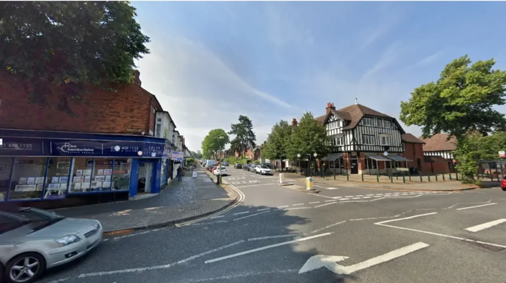
Bournville is a unique garden village providing children with expansive parkland, historic village greens, strict conservation rules, and purpose-built community spaces.
Founded by Quaker industrialist George Cadbury, the district prioritizes open space, health, and family-oriented residential layout.
Bournville was created in 1895 by George and Richard Cadbury to provide high quality housing for workers away from industrial pollution. The Cadbury family established the Bournville Village Trust in 1900 to manage the estate. The area architecture features cottage style homes, tree-lined avenues, and brick construction designed according to garden city movement planning principles.
The estate operates under architectural covenants administered by the Bournville Village Trust. Covenants restrict external property alterations, enforce garden maintenance, and protect public parkland from commercial development. Educational facilities include Bournville Village Primary School and Dame Elizabeth Cadbury School. The area retains traditional Quaker influence, meaning local commercial premises do not hold licenses to sell alcohol on the core estate.
Purchasing a home in Bournville requires navigating specific trust procedures. Prospective buyers inspect properties located within the B30 postcode sector. Buyers review the Bournville Village Trust Design Guide during the conveyancing process to understand property maintenance restrictions. Residents pay a small annual management fee to the trust for the upkeep of community parks and village facilities.
Key locations within Bournville highlight its historic urban planning principles. Bournville Village Green acts as the central focal point, surrounded by local shops, the Rest House, and the historic Carillon tower.
Cadbury World sits on the edge of the estate, providing tourist facilities and industrial heritage. Parklands such as Rowheath Pavilion and Gardens offer sports fields, playgrounds, and community events.
Statistical assessments show property prices in Bournville average £325000 according to HM Land Registry records. Semi-detached homes average £340000, while terraced houses average £265000. The Bournville Village Trust manages over 100 acres of public open space and parkland, ensuring ten percent of the total estate area remains dedicated green space.
Choosing Bournville provides children with a safe environment preserved by strict local planning standards. The prohibition of licensed premises and industrial development maintains quiet residential streets. Property owners benefit from estate management that preserves architectural character and community parkland over generations.
Is Edgbaston Suitable for Families Seeking Elite Schools and Space?
Edgbaston is highly suitable for families seeking elite independent schools, expansive period properties, historic botanical gardens, and peaceful tree-lined avenues. Located immediately southwest of Birmingham city centre, it represents the city’s premier affluent residential district.
Edgbaston developed during the nineteenth century under the ownership of the Calthorpe Estate, which controlled suburban land usage. Strict leasehold controls preserved single-family mansions, wide roads, and low-density housing patterns. The suburb contains architectural styles spanning Regency villas, Victorian double-fronted houses, and modern executive homes.
The district functions as an educational and sporting hub within the West Midlands region. Elite independent schools dominate the area, including King Edward’s School, King Edward VI High School for Girls, and Highfield Hall.
porting infrastructure includes the Edgbaston Cricket Ground, the Edgbaston Priory Club for tennis and squash, and the Edgbaston Golf Club. Public leisure facilities centre around the 15-acre Birmingham Botanical Gardens.
Securing a family residence in Edgbaston involves navigating private estate frameworks. Buyers target properties within the B15 postcode district, reviewing leasehold or freehold terms managed by the Calthorpe Estate.
Families applying for independent schools complete selective entrance examinations held annually in November and January. Transport into the central business district relies on the West Midlands Metro tram extension along Broad Street to Edgbaston Village.
Distinct pockets within Edgbaston offer varied residential environments. The Calthorpe Estate core contains listed Regency mansions situated along Westbourne Road and Wellington Road. Edgbaston Village features fine dining restaurants, boutique shops, and commercial offices housed in restored period buildings. The areas bordering Cannon Hill Park provide traditional family homes with immediate parkland access.
According to data from NurseryMatch and HM Land Registry, B15 Edgbaston recorded an average home price of £389870. Large detached period properties regularly exceed £1000000 on the open market. Data indicates the area features an exceptionally low crime rate of 22.29 per 1000 residents, making it one of the safest wards in Birmingham.
Moving to Edgbaston secures immediate access to the top independent secondary schools in the West Midlands. The large footprint of period housing provides extensive private gardens and internal living space for growing households. Estate stewardship by the Calthorpe Estate ensures low commercial density and long-term capital preservation.
How Do Moseley and Kings Heath Compare for Family Community Life?
Moseley and Kings Heath offer vibrant community life characterized by independent retail corridors, historic public parks, strong state primary schools, and creative arts scenes. Both South Birmingham suburbs feature Edwardian and Victorian housing popular with young families.
Moseley and Kings Heath developed along the Alcester Road transport corridor during the late Victorian and Edwardian eras. Moseley established an early reputation as an artistic residential area, while Kings Heath grew as a commercial market suburb. Both areas feature red-brick terraced housing, semi-detached family homes, and converted period properties.
Community life operates through local high street economies and active residents associations. Moseley centres on a historic village green, hosting monthly farmers markets and the annual Moseley Folk Festival.
Kings Heath features a pedestrianized high street zone, independent retail shops along York Road, and active community centres. Educational institutions serving both suburbs include King Edward VI Camp Hill School for Boys and King Edward VI Camp Hill School for Girls.
Families choosing between these suburbs evaluate distinct lifestyle features. Buyers searching in B13 inspect Moseley properties near Highbury Park and Private Park. Buyers searching in B14 analyze Kings Heath properties within the catchment areas of Colmore Infant and Nursery School. Commuters utilize major bus routes along Alcester Road or prepare for upcoming rail station re-openings on the Camp Hill Line.
Key parklands illustrate the open space available to children in both districts. Cannon Hill Park borders Moseley, offering 250 acres of parkland, boating lakes, and the Midlands Arts Centre. Highbury Park sits between Moseley and Kings Heath, featuring historic grounds originally owned by Joseph Chamberlain. Kings Heath Park provides dedicated botanical displays, tearooms, and children’s play areas.
HM Land Registry data reveals average property prices in Moseley stand at £335000, while Kings Heath records an average price of £295000. Colmore Infant and Nursery School in Kings Heath maintains an Outstanding Ofsted rating. The reopening of Moseley and Kings Heath railway stations will deliver direct six-minute train connections to Birmingham New Street.
Comparing these areas helps parents align housing budgets with local lifestyle preferences. Kings Heath provides more affordable terrace housing options alongside highly rated infant schools. Moseley delivers larger period properties, private green spaces, and a village atmosphere for long-term family living.
What is the safest neighbourhood in Birmingham for young families?
Sutton Coldfield and Edgbaston consistently rank among the safest areas in Birmingham for families. Police data shows outer suburban wards like Four Oaks and Edgbaston B15 maintain significantly lower crime rates than inner-city districts. Private estate management and active neighbourhood watch schemes further enhance security in these suburban zones.
Are state schools in Birmingham good enough compared to private options?
Birmingham features exceptional state school options including world-class grammar schools governed by the King Edward VI Foundation. Primary schools such as Harborne Primary and Colmore Infant School hold Outstanding Ofsted ratings, delivering top-tier education equal to independent institutions without tuition fees.
How far is the commute from Sutton Coldfield to central Birmingham?
Commuting from Sutton Coldfield to Birmingham New Street takes approximately 20 minutes using West Midlands Railway services. Frequent trains run throughout the day from Sutton Coldfield, Four Oaks, and Wylde Green stations. Driving via the A38 takes between 25 to 45 minutes depending on peak morning traffic conditions.
What is the average house price for a family home in South Birmingham?
Family homes in popular South Birmingham suburbs like Harborne, Moseley, and Bournville average between £325000 and £380000. Three-bedroom semi-detached properties range from £310000 to £350000, while larger four-bedroom detached period houses in prime zones often exceed £500000.
Which Birmingham suburb offers the best balance of parks and high street shops?
Harborne and Moseley provide the best balance of green spaces and independent commercial high streets. Harborne features a bustling high street alongside Queens Park and the Harborne Walkway. Moseley combines an award-winning village center with immediate access to Highbury Park and Cannon Hill Park.