Checking Birmingham roadworks in real time requires utilizing digital mapping platforms like one.network alongside official tracking portals managed by Birmingham City Council, National Highways, and Transport for West Midlands to review active street permits, lane closures, and transit diversions.
- How Does Birmingham City Council Manage Local Street Permits?
- Which Public Transport Services Face Regular Diversions?
- What Strategic Highways Impact Regional West Midlands Commutes?
- How do I check live traffic jams on the M6 near Birmingham?
- How do I report an unannounced road closure in Birmingham?
- Does Birmingham Clean Air Zone apply during roadwork diversions?
- Where can I find planned HS2 road closures in Birmingham?
- How far in advance does Birmingham City Council publish roadworks?
Birmingham City Council works alongside utility providers to manage all local highway work within the municipal boundary. The local authority licenses works through statutory permits governed by the New Roads and Street Works Act 1991. The unified digital platform one.network aggregates these permits into a single live geospatial map.
Transport for West Midlands tracks regional network impacts, combining council street data with bus, rail, and West Midlands Metro service adjustments. National Highways monitors strategic trunk roads like the M6, M5, A38(M), and A456. Commuters access live feeds, road closures, and maintenance schedules through these centralized portals to navigate around urban congestion efficiently.
Historically, roadwork tracking relied on manual physical notices, localized radio broadcasts, and paper highway schedules published by local councils. The digitisation of UK highway administration transformed traffic management across major metropolitan zones over the past two decades.
In 2020, the Department for Transport mandated the Street Manager digital service, forcing all local authorities and utility firms to upload live works data into a standardized database. This policy enabled central feeds to deliver immediate updates on active dig sites, emergency utility repairs, and traffic light maintenance across the West Midlands conurbation.
The structural framework of Birmingham travel tracking relies on three distinct layers. The municipal layer comprises local arterial roads, residential streets, and urban shopping corridors managed by Birmingham City Council. The strategic road network layer covers dual carriageways and motorways overseen by National Highways. The regional transit integration layer combines public transport routes and major infrastructure developments overseen by Transport for West Midlands. Together, these systems log permit numbers, exact start dates, estimated completion dates, traffic management styles, and operating organizations across every square mile of the city.
Drivers and transit passengers access this tracking ecosystem through direct web portals, geographic mapping tools, and automated notifications. Commuters start by selecting their primary route on one.network or the Transport for West Midlands disruption portal. Users filter active works by severity, ranging from minor footway maintenance to full carriageway closures.
Real-world applications include checking route viability before morning commutes, planning commercial logistics along industrial corridors like Tyburn Road, and avoiding major construction zones around HS2 work sites at Curzon Street and Saltley Viaduct.
Data from recent transport studies shows that real-time journey planning reduces urban congestion delays by up to 18 percent for regular commuters. Birmingham manages thousands of active street permits annually, driven by utility upgrades, housing development connections, and public transport extensions.
Navigating this network effectively protects commuters from unexpected delays, lowers vehicular emissions from idling engines, and maintains smooth transit movement across the central ring road and key radial corridors like the A38 Bristol Road and A45 Coventry Road.
How Does Birmingham City Council Manage Local Street Permits?

Birmingham City Council manages local street permits through statutory licensing frameworks that require utility companies, developers, and council contractors to apply for formal highway access, state working timeframes, and implement mandatory traffic control measures prior to starting work.
Birmingham City Council acts as the central highway authority for non-trunk roads within city boundaries. Under the West Midlands Permit Scheme, any organization planning to dig up a street, erect scaffolding, or close a lane must secure a street works permit.
The council reviews each application to prevent conflicting works on adjacent roads, minimizing network paralysis. Emergency works, such as burst water mains or gas leaks, receive immediate temporary authorization but must be logged within statutory deadlines.
Historically, highway authorities used non-permit notification schemes under the 1991 legislation, giving local councils minimal control over when utility companies dug up roadways. The introduction of formal permit schemes in the 2010s gave Birmingham City Council the authority to approve, modify, or reject planned work windows. This legal shift allowed urban planners to protect critical commuter corridors during major events, peak rush hours, and regional retail periods like the Christmas shopping season.
The structure of the local permit system categorizes works into standard classifications based on planned duration and traffic impact. Major works last more than 10 days or require traffic regulation orders for road closures.
Standard works run between 4 and 10 days, while minor works take 3 days or less. Immediate works cover emergency repairs required to prevent public danger or severe infrastructure damage. Each permit specifies mandatory working hours, noise restrictions, and required traffic management setups like temporary three-way traffic lights or signed diversions.
The application process for a street permit follows a strict administrative mechanism. Utility providers like Severn Trent Water, Cadent Gas, National Grid, and Openreach submit electronic permit requests detailing the location, coordinates, work depth, and traffic impact.
Council officers evaluate the request against existing roadworks on parallel routes. If approved, the system generates a unique permit reference code and publishes the details to public tracking maps. Field inspectors conduct site audits to verify that contractors adhere to safety rules and clearance schedules.
Statistics from local government highway reports indicate that over 30,000 street work permits are processed across Birmingham each year. Utility upgrades account for roughly 65 percent of these permits, with highway maintenance and private development making up the remainder.
Enforcing rigid permit compliance prevents widespread gridlock across major hubs like Five Ways, Erdington High Street, and Selly Oak. Strict oversight protects surface road capacity, preserves highway infrastructure, and holds third-party contractors accountable for prompt site reinstatement.
Which Public Transport Services Face Regular Diversions?
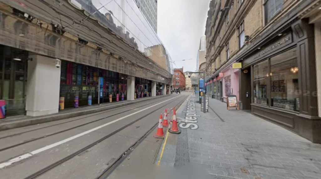
Public transport services across Birmingham experience regular diversions when surface road closures or infrastructure upgrades disrupt local bus routes managed by National Express West Midlands, West Midlands Metro tram lines, and regional rail connections.
Bus networks face the most direct operational impacts from urban roadworks. National Express West Midlands, the primary bus operator in the region, alters service routes when carriageway closures occur along key arteries.
The West Midlands Metro extension project through Birmingham city centre creates long-term planned diversions along key commercial avenues. Regional rail services managed by West Midlands Railway and Avanti West Coast experience disruptions primarily when bridge repairs or level crossing maintenance require temporary track closures or replacement bus services.
Urban bus networks in the West Midlands evolved alongside fixed tramways and industrial railway lines throughout the 20th century. As post-war redevelopment replaced trams with diesel buses, transit routes became linked to the city’s surface road layout.
Large-scale urban regeneration projects in the 21st century, including the Big City Plan and Birmingham Transport Plan, created necessary service diversions to accommodate long-term infrastructure overhauls, pedestrianisation projects, and rapid transit expansions.
The public transport disruption hierarchy consists of three core operational areas. Bus diversions reroute vehicles along parallel residential or commercial roads, temporarily closing existing bus stops and establishing temporary boarding poles. Tram service adjustments utilize split-line operations or temporary shuttle buses when track construction affects central street sections.
Rail rail disruptions replace train departures with rail replacement bus services operating between key interchanges like Birmingham New Street, Moor Street, and Snow Hill stations.
When roadworks force a bus route modification, transport operators execute a standardized service revision process. Route planners collaborate with Transport for West Midlands to map alternative corridors capable of handling double-deck vehicles.
Digital signage at affected bus stops updates passengers on temporary boarding locations, while live GPS tracking feeds inside mobile transport apps reflect modified arrival times. Driver management teams issue updated route sheets ensuring drivers adhere strictly to authorized diversion paths.
Transport for West Midlands operational data shows that over 80 percent of daily public transit journeys in the region take place on the bus network. Major infrastructure projects, such as the High Speed 2 (HS2) construction around Washwood Heath and Saltley Viaduct, require multi-year diversions affecting thousands of daily passengers.
Tracking these transit disruptions helps commuters choose efficient travel routes, reduces overcrowding on alternative service lines, and maintains reliable access to major employers, hospitals, and educational campuses.
What Strategic Highways Impact Regional West Midlands Commutes?
Strategic highways impacting regional West Midlands commutes consist of high-density motorway networks and major A-roads, including the M6, M5, M42, A38(M) Aston Expressway, and A45, which are managed directly by National Highways.
National Highways oversees the Strategic Road Network passing through the West Midlands region. The M6 motorway forms the primary northern and eastern bypass, connecting Birmingham to Staffordshire and the North West. The M5 motorway links the city to the South West, joining the M6 at the Ray Hall Interchange.
The A38(M) Aston Expressway provides a direct seven-lane tidal flow connection between central Birmingham and the M6 at Junction 6, known locally as Spaghetti Junction. The A45 serves as a core east-west corridor linking the city to Birmingham Airport and the M42.
The construction of the West Midlands motorway network during the 1960s and 1970s created one of the most complex highway interchanges in Europe. Spaghetti Junction opened to traffic in 1972 to funnel regional and national transit around the urban core.
Decades of heavy freight usage and rising commuter vehicle numbers necessitated ongoing structural repairs, elevated viaduct maintenance, and the implementation of Smart Motorway technology featuring active lane management and variable speed limits across the regional ring road.
The strategic road network around Birmingham is organized into three distinct operational rings. The inner highway ring comprises the A4540 Queensway, directing local traffic around the central business district. The intermediate highway ring includes key A-roads like the A1824 and A38, connecting suburban communities to inner industrial districts.
The outer motorway ring features the M6, M5, M42, and M6 Toll, carrying cross-country freight and long-distance passenger traffic around the urban sprawl.
National Highways manages maintenance and emergency responses through centralized regional operations centers. Traffic officers patrol strategic motorways around the clock, deploying overhead gantries, temporary lane closures, and electronic message boards to control vehicle flow.
When scheduled maintenance occurs, contractors perform overnight carriageway resurfacing, bridge joint replacements, or barrier repairs. These operations are coordinated to conclude before early morning peak travel hours commence.
Traffic statistics indicate that the M6 section through Birmingham carries over 160,000 vehicles daily, making it one of the busiest motorway stretches in the United Kingdom. Infrastructure projects, such as structural repairs on the Tame Valley Viaduct along the A38(M), require long-term traffic restrictions that reverberate across local arterial roads.
Monitoring strategic highway conditions allows regional drivers to alter journey start times, choose alternative ring road routes, or switch to rail alternatives during peak disruption windows.
How do I check live traffic jams on the M6 near Birmingham?
Check the official National Highways website or live mapping platforms like one.network for real-time camera updates and gantry alerts on the M6.
How do I report an unannounced road closure in Birmingham?
Report unauthorized or unannounced street closures directly to Birmingham City Council using their online highways portal or telephone customer service line.
Does Birmingham Clean Air Zone apply during roadwork diversions?
Drivers diverted into the Clean Air Zone due to official council roadworks are typically exempt, provided they follow the designated signed diversion route strictly.
Where can I find planned HS2 road closures in Birmingham?
Planned HS2 road closures and long-term viaduct construction updates are listed on the dedicated Transport for West Midlands HS2 major projects page.
How far in advance does Birmingham City Council publish roadworks?
Standard roadwork permits are published on public tracking maps 7 to 10 days in advance, while major roadworks are listed weeks prior.