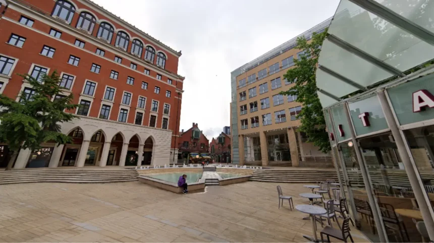
Selecting the ideal neighborhood in Greater Birmingham requires balancing real estate valuations, transport connectivity, local crime statistics, and educational catchment zones to secure a property that fits long-term family or professional goals.
- What Makes Edgbaston the Top Choice for Upscale Living?
- Why Is Harborne Ideal for Commuting Professionals and Families?
- How Does Sutton Coldfield Serve Suburban Family Living?
- Why Is the Jewellery Quarter Popular With Young Professionals?
- How Do Moseley and Kings Heath Compare for Culture and Community?
The West Midlands urban area covers 231 square miles across central England, with Birmingham serving as its economic and administrative center. Historic industrial developments created distinct districts that evolved from manufacturing hubs into suburban communities.
Modern housing inventory includes Victorian terraces, Edwardian villas, mid-century detached properties, and high-rise apartments built during urban regeneration projects.
Property buyers and tenants analyze regional market metrics to identify areas with long-term stability and high capital growth. Suburban expansion along major rail lines established primary commuter corridors connecting central Birmingham to northern and southern residential districts. Key infrastructure investments like the West Midlands Metro extensions and Camp Hill line rail reopenings directly influence neighborhood accessibility and local land values.
Residential decisions depend on structural attributes including council tax bands, proximity to healthcare facilities like Queen Elizabeth Hospital, and access to rated primary and secondary schools. Commercial hubs, green space allocations, and community safety records establish the primary livability index for each postal sector.
What Makes Edgbaston the Top Choice for Upscale Living?
Edgbaston provides affluent residential streets, historic conservation architecture, and immediate proximity to major medical and academic employment centers, making it a primary destination for medical consultants, university academics, and corporate executives seeking spacious homes close to the central business district.
The district of Edgbaston covers the B15 postal sector under the administration of the Calthorpe Estate. Land development regulations established in the early nineteenth century limited industrial growth and preserved residential green space, creating wide tree-lined avenues and large plots.
Historic architectural styles dominate the local housing stock, featuring Georgian townhouses, Victorian manor homes, and Edwardian detached structures. Residential density remains low compared to adjacent urban sectors, protecting property valuations during market fluctuations.
Two major regional institutions sit within the Edgbaston boundary: the University of Birmingham and the Queen Elizabeth Hospital complex. These facilities generate constant housing demand from medical professionals, research personnel, and international academic leaders seeking permanent or rental accommodation.
Schools in Edgbaston include independent institutions such as King Edward’s School, King Edward VI High School for Girls, and Highfield Hall. State-funded options include St George’s Church of England Primary School and Edgbaston High School, maintaining high performance ratings in national educational rankings.
Transport access centers on Five Ways and University railway stations along the Cross-City Line. Commute times to Birmingham New Street average under eight minutes, while road access connects directly to the A38 Bristol Road toward the M5 motorway network.
Leisure amenities include the Birmingham Botanical Gardens, Edgbaston Golf Club, and Edgbaston Priory Club. High-end dining establishments line the Calthorpe Village precinct along Highfield Road, featuring Michelin-starred restaurants and boutique commercial services.
Why Is Harborne Ideal for Commuting Professionals and Families?
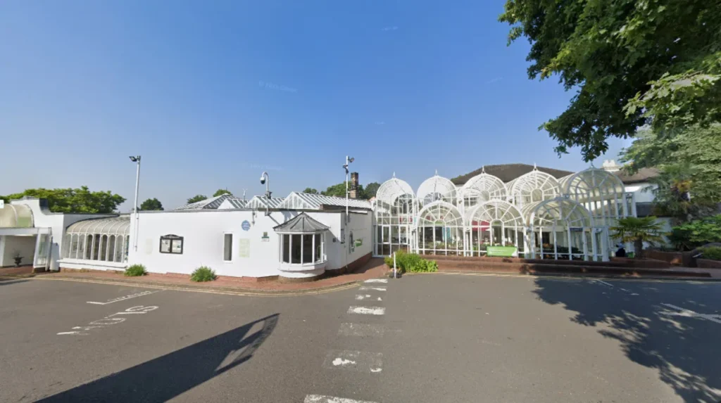
Harborne combines a vibrant independent high street with high-performing primary schools and direct public transport routes to central employment zones, delivering a balanced urban village environment that appeals to working parents, healthcare professionals, and young families.
Located southwest of the city center in the B17 postcode, Harborne sits adjacent to Edgbaston and Selly Oak. The area developed around a historic village core before expanding during the late Victorian era to accommodate urban growth.
Housing options consist of Victorian terraced houses, mid-century family homes, and modern apartment developments. Property values remain consistently above the Birmingham municipal average due to sustained demand across all residential brackets.
Harborne High Street serves as the economic hub of the suburb, offering a mix of national retailers, independent bakeries, gastro pubs, and supermarkets. The commercial strip maintains low vacancy rates and supports a local evening economy.
Educational facilities include Harborne Primary School, St Mary’s Catholic Primary School, and Lordswood Girls’ School. These institutions maintain catchment zones that directly influence residential property pricing on adjacent streets.
Bus corridors operated by National Express West Midlands provide direct transit connections along Harborne Road to Birmingham New Street and Colmore Row. Transit travel times range between fifteen and twenty-five minutes depending on traffic flow.
Outdoor recreational space is provided by Harborne Walkway, Grove Park, and Queens Park. The Harborne Walkway follows a former railway line, providing pedestrian and cycling access to surrounding districts without motor vehicle interaction.
How Does Sutton Coldfield Serve Suburban Family Living?
Sutton Coldfield provides extensive green spaces, historic grammar school education options, and large detached housing stock, making it the leading suburban destination for growing families seeking space, safety, and direct regional rail access.
Situated eight miles northeast of Birmingham city center, Sutton Coldfield operates within the royal borough boundary covering B72, B73, B74, and B75 postcodes. The region retains a distinct suburban layout separate from the dense urban core.
Residential architecture features interwar semi-detached houses, mid-century detached plots, and modern executive gated developments. Average lot sizes in areas like Four Oaks and Little Aston exceed city averages, accommodating multi-vehicle driveways and private gardens.
Sutton Park forms the centerpiece of the local environment, offering 2,400 acres of national nature reserve consisting of woodland, heathland, and lakes. The park supports outdoor activities, sports clubs, and ecological conservation initiatives.
Educational infrastructure includes elite selective institutions like Bishop Vesey’s Grammar School and Sutton Coldfield Grammar School for Girls. Comprehensive schools like Plantsbrook School and Arthur Terry School provide high educational standards across primary and secondary levels.
Rail connectivity relies on four stations along the Cross-City Line: Sutton Coldfield, Four Oaks, Wylde Green, and Boldmere. Regular train services connect residents to Birmingham New Street in under twenty-five minutes, catering to daily city commuters.
Commercial services center around the Gracechurch Shopping Centre and Mere Green retail precinct. These developments offer grocery hubs, medical practices, gyms, and family-oriented dining venues.
Why Is the Jewellery Quarter Popular With Young Professionals?
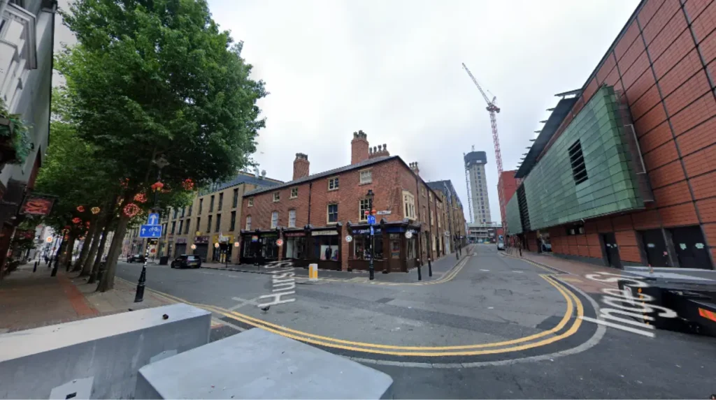
The Jewellery Quarter offers historic industrial conversion apartments, a thriving independent commercial scene, and pedestrian access to the central business district, serving as a top location for young professionals, entrepreneurs, and city-center workers.
The Jewellery Quarter spans the B18 postcode along the northwestern edge of central Birmingham. Established in the eighteenth century as a metalworking hub, the area contains over two hundred listed historic buildings.
Urban regeneration converted historic jewelry workshops and Victorian manufacturing warehouses into residential loft apartments and modern townhouse units. These properties feature exposed brickwork, large factory windows, and open-plan living layouts.
Economic activity retains a dual focus, supporting traditional jewelry manufacturing alongside digital agencies, architecture practices, and creative firms. St Paul’s Square represents the central green space, surrounded by Georgian architecture and independent venues.
Transport infrastructure features the Jewellery Quarter station, serving both the West Midlands Metro tram network and national rail connections. Commuters reach Snow Hill station in three minutes or walk to Colmore Row in fifteen minutes.
Retail amenities include over eighty independent bars, coffee shops, and restaurants, eliminating reliance on chain establishments. The local museum district records the historic industrial heritage through preserved workshop sites.
How Do Moseley and Kings Heath Compare for Culture and Community?
Moseley and Kings Heath deliver vibrant community environments with independent business sectors, public parks, and historic housing stock, attracting creative workers, young families, and professionals seeking neighborhood identity.
Moseley sits three miles south of the city center in the B13 postcode, while Kings Heath occupies the adjacent B14 sector. Both suburbs developed rapidly during the late Victorian and Edwardian eras along major southern tramways.
Housing styles include large Edwardian villas, Victorian red-brick terraces, and mid-century infill properties. Moseley offers larger period properties set back from main roads, whereas Kings Heath contains higher-density terraced streets with accessible entry-level prices.
Commercial districts center on Moseley Village and Kings Heath High Street. Moseley emphasizes independent boutiques, farmers’ markets, and cultural venues, while Kings Heath offers a mixture of national retail brands, local markets, and music venues.
Green spaces include Moseley Private Park, Cannon Hill Park, and Kings Heath Park. Cannon Hill Park provides boating lakes, sports courts, and the Midlands Arts Centre, attracting visitors from across the metropolitan region.
Infrastructure improvements include the reopening of passenger rail stations along the Camp Hill line at Moseley Village, Kings Heath, and Pineapple Road. This rail corridor reduces transit travel times to Birmingham New Street to under twelve minutes.
Schools in the area include King Edward VI Camp Hill School for Boys and King Edward VI Camp Hill School for Girls in neighboring Kings Norton, along with local primary academies. Catchment areas across B13 and B14 show consistent residential demand due to these educational options.
What is the safest area to live in Birmingham for a family?
Edgbaston, Harborne, and Sutton Coldfield consistently rank as the safest residential areas in Birmingham. These districts feature lower crime rates, established community watches, and family-oriented neighborhoods with long-term residents.
Which Birmingham areas offer the fastest commute to the city center?
The Jewellery Quarter, Edgbaston, and Moseley provide the fastest transit times to the central business district. Walkable paths, tram connections, and Camp Hill rail links allow residents to reach Colmore Row in under fifteen minutes.
Is Sutton Coldfield better for families than Harborne?
Sutton Coldfield offers larger homes, private gardens, and direct access to Sutton Park, making it ideal for large families. Harborne provides closer proximity to central hospitals and universities, serving families who prefer urban conveniences over suburban space.
Where are property prices growing fastest in Birmingham?
Regeneration zones like Digbeth, Stirchley, and areas along the Camp Hill rail line recorded strong capital growth. Public transport infrastructure investments continue to boost property demand in these expanding suburban hubs.
Which Birmingham neighborhoods have the best state schools?
Sutton Coldfield, Edgbaston, and Kings Heath host top-performing state grammar and primary schools. Catchment zones around Bishop Vesey’s and King Edward VI Camp Hill schools maintain high housing demand.