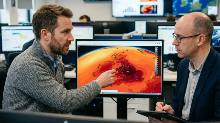
UK 39C weather models are high-performance computer algorithms that simulate atmospheric physics to forecast extreme 39 degrees Celsius temperatures. These models process surface observations, satellite imagery, and thermodynamic calculations across grid cells to project extreme summer heatwaves accurately.
- Core Architecture of High-Resolution Numerical Weather Prediction Systems
- Global Forecast System (GFS) versus European Integrated Forecasting System (IFS)
- Why Do Weather Models Forecast 39C Temperatures in the United Kingdom?
- Synoptic Atmospheric Conditions and Iberian Plume Dynamics
- Soil Moisture Depletion and Land-Atmosphere Feedback Loops
- How Have UK Weather Models Evolved to Capture Extreme Heat Since 2019?
- Historical Milestones from the 2019 Cambridge Record to the 2022 Coningsby Record
- Model Grid Resolution Upgrades and Supercomputing Enhancements
- How Do Ensemble Prediction Systems Calculate the Probability of 39C Heatwaves?
- Initial Condition Perturbations and Multi-Model Ensembles
- Statistical Calibration and Extreme Value Index Metrics
- What Are the Primary Challenges in Forecasting 39C Extreme Heat in the West Midlands and Birmingham?
- Microclimate Variations and Urban Heat Island Dynamics
- Convection Parameterization and Cloud Cover Uncertainties
- What Infrastructure Impacts Do 39C Weather Model Forecasts Trigger Across the UK?
Numerical weather prediction (NWP) forms the foundation of modern meteorology. Supercomputers operated by global meteorological organizations process billions of environmental measurements every day to calculate future atmospheric states. When forecasting extreme heat events, weather models solve complex fluid dynamics equations, radiative transfer equations, and thermodynamic state equations.
Core Architecture of High-Resolution Numerical Weather Prediction Systems
Numerical weather prediction systems rely on 3 physical components—data assimilation modules, dynamical cores, and physical parameterization schemes. Data assimilation integrates real-time observational data from 4 primary sources—weather satellites, land radiosondes, commercial aircraft sensors, and marine weather buoys. These inputs construct a 3-dimensional snapshot of the atmosphere. The dynamical core calculates mass conservation, momentum, and thermal energy movement across structured grid meshes.
Physical parameterization schemes calculate processes that occur at scales smaller than the model grid. These sub-grid processes include 3 specific atmospheric phenomena—cloud microphysics, boundary layer turbulence, and solar radiation reflection. For the United Kingdom, high-resolution models calculate parameters at horizontal grid spacings down to 1.5 kilometers. This fine resolution allows supercomputers to model localized warming trends, coastlines, and elevation variations accurately.
Global Forecast System (GFS) versus European Integrated Forecasting System (IFS)
The United Kingdom relies on 3 leading global weather models—the European Centre for Medium-Range Weather Forecasts Integrated Forecasting System (ECMWF IFS), the United States National Oceanic and Atmospheric Administration Global Forecast System (NOAA GFS), and the UK Meteorological Office Unified Model (Met Office UM). Each system uses distinct mathematical approximations and spatial resolutions to project extreme heatwave trajectories.
The ECMWF IFS operates at a global horizontal resolution of 9 kilometers. It runs 2 main operational cycles daily at 00:00 UTC and 12:00 UTC. Meteorologists consider the IFS the most accurate global deterministic model for tracking 850 hectopascals (hPa) thermal plumes 7 to 10 days in advance.
The NOAA GFS operates at a 13-kilometer resolution and runs 4 daily operational cycles—00:00 UTC, 06:00 UTC, 12:00 UTC, and 18:00 UTC. The GFS updates faster than European models, providing early detection signals for extreme heat surges.
The Met Office Unified Model utilizes a specialized nested configuration called the UKV (United Kingdom Variable resolution) model. The UKV model covers the British Isles at 1.5-kilometer grid spacing. This ultra-high resolution resolves small-scale surface interactions that push temperatures to 39 degrees Celsius or higher.
Why Do Weather Models Forecast 39C Temperatures in the United Kingdom?
Weather models forecast 39 degrees Celsius temperatures when synoptic pressure patterns channel superheated air from North Africa and Iberia across Western Europe into the United Kingdom. Models register this thermal advection combined with intense solar radiation and prolonged soil desiccation.
Predicting extreme heat in a maritime climate requires precise modeling of atmospheric circulation patterns. The British Isles sit between the Atlantic Ocean and Continental Europe. Prevailing south-westerly winds bring mild air masses, making 39 degrees Celsius temperatures an extreme statistical anomaly. Weather models identify specific synoptic configurations that override the typical cooling influence of the Atlantic Ocean.
Synoptic Atmospheric Conditions and Iberian Plume Dynamics
Extreme heatwaves in the United Kingdom depend on a synoptic phenomenon known as the Iberian Plume. An Iberian Plume forms when a deep upper-level low-pressure system sits off the coast of Portugal while a strong high-pressure ridge builds over Western Europe. This atmospheric dipole acts as a giant thermodynamic pump.
The synoptic flow draws hot air northward from the Sahara Desert across Spain and France. As the air mass travels over the dry Iberian plateau, solar heating warms the lower troposphere. The 850 hPa temperature level—located approximately 1,500 meters above sea level—serves as the primary metric for tracking air mass intensity. When 850 hPa temperatures reach 20 degrees Celsius to 24 degrees Celsius over Southern England, surface temperatures can exceed 38 degrees Celsius under clear skies and light winds.
High-pressure systems involved in these events often form an Omega Block pattern. An Omega Block is a stable atmospheric configuration where a high-pressure zone is sandwiched between 2 low-pressure troughs. This structure diverts rain-bearing Atlantic jet stream currents northward toward Iceland, allowing heat to accumulate over Britain for several consecutive days.
Soil Moisture Depletion and Land-Atmosphere Feedback Loops
Computer models account for surface hydrology when calculating maximum surface air temperatures. When solar radiation strikes moist soil, energy is consumed by evapotranspiration—the process where water evaporates from land and leaves transpire moisture into the air. This process converts net radiation into latent heat, which cools the ground surface and surrounding air mass.
During prolonged summer dry spells, soil moisture levels drop below critical wilting thresholds. When soil moisture drops to near zero, evapotranspiration shuts down entirely. incoming solar radiation converts directly into sensible heat, which raises surface air temperatures. Weather models use land-surface modules—such as the Joint UK Land Environment Simulator (JULES)—to track soil moisture profiles across 4 depth layers from 0 centimeters to 3 meters. In dry conditions, sensible heat flux dominates, adding 2 degrees Celsius to 4 degrees Celsius to peak daily temperatures, driving regional model output toward 39 degrees Celsius.
How Have UK Weather Models Evolved to Capture Extreme Heat Since 2019?
UK weather models evolved by increasing spatial grid resolution, integrating artificial intelligence algorithms, and improving land-surface physics after 2019. These technological upgrades allow supercomputers to capture localized microclimates, land-atmosphere feedbacks, and unprecedented temperature spikes exceeding historical British records.
Historically, numerical weather models in Europe struggled to output surface temperatures near 40 degrees Celsius because high-end extremes fell outside model historical training domains and physical tuning parameters. Events in July 2019 and July 2022 forced global forecasting centers to recalibrate their thermodynamic equations and physical parameterizations.
Historical Milestones from the 2019 Cambridge Record to the 2022 Coningsby Record
The United Kingdom climate record underwent unprecedented shifts within a 3-year period. On July 25, 2019, the official British maximum temperature record was broken when Cambridge Botanic Garden recorded 38.7 degrees Celsius. Numerical models predicted temperatures between 36 degrees Celsius and 37 degrees Celsius 3 days prior, slightly underestimating the final peak temperature.
On July 18, 2022, Cambridge recorded 38.1 degrees Celsius. On July 19, 2022, the record was surpassed when RAF Coningsby in Lincolnshire reached 40.3 degrees Celsius. This marked the first time in recorded British history that temperatures exceeded 40 degrees Celsius.
Operational weather models demonstrated remarkable predictive capability during the July 2022 heatwave. The GFS and ECMWF models produced individual ensemble runs showing temperatures of 39 degrees Celsius to 40 degrees Celsius up to 10 days before the event. Operational meteorologists initially treated these raw 39 degrees Celsius model outputs with caution due to the lack of historical precedent. The event confirmed that modern physical parameterization algorithms accurately model severe thermodynamic surges under accelerating climate change.
Model Grid Resolution Upgrades and Supercomputing Enhancements
Following the 2022 heatwave, major meteorological institutions invested heavily in supercomputing hardware to upgrade model architecture. The Met Office deployed a Cray EX supercomputer architecture to enhance operational simulation capabilities. This computing system performs over 14 quadrillion calculations per second, enabling faster operational model runs and higher physical accuracy.
In parallel, forecasting centers implemented 2 major AI weather models—ECMWF AIFS (Artificial Intelligence Forecasting System) and Google DeepMind GraphCast. Neural network models train on decades of ECMWF ERA5 reanalysis data spanning from 1940 to the present. Machine learning algorithms process non-linear atmospheric patterns in minutes, matching or exceeding traditional numerical weather models in predicting 850 hPa heat plumes 5 to 10 days in advance.

How Do Ensemble Prediction Systems Calculate the Probability of 39C Heatwaves?
Ensemble prediction systems calculate 39 degrees Celsius probabilities by running multiple simulations with slightly altered initial atmospheric conditions. By analyzing 50 or more distinct scenario variations, meteorologists quantify the statistical likelihood, intensity, and geographical range of extreme temperature events.
A single operational weather model run—known as a deterministic forecast—provides a single calculation of future weather based on the exact current atmospheric state. Small observational errors in initial temperature, humidity, or wind speed compound rapidly over time due to the chaotic nature of atmospheric dynamics. Meteorologists utilize ensemble forecasting to manage this inherent atmospheric uncertainty.
Initial Condition Perturbations and Multi-Model Ensembles
Ensemble prediction systems (EPS) run a suite of parallel model simulations called ensemble members. The ECMWF Ensemble Prediction System consists of 51 distinct members—1 unperturbed control run and 50 perturbed members. The NOAA Global Ensemble Forecast System (GEFS) contains 31 distinct members.
Meteorologists introduce small, deliberate mathematical variations—termed perturbations—into the starting parameters of each member. These perturbations reflect real-world observational uncertainties across satellite and surface networks.
When all 51 ensemble members predict different peak temperatures, forecast confidence remains low. When 40 out of 51 members project maximum temperatures exceeding 38.5 degrees Celsius across Central and Eastern England, forecast confidence rises above 75 percent. Multi-model ensembles combine outputs from ECMWF EPS, NOAA GEFS, and UKMO MOGREPS (Met Office Global and Regional Ensemble Prediction System) to eliminate single-model structural bias.
Statistical Calibration and Extreme Value Index Metrics
To evaluate extreme weather events, forecasters utilize 2 advanced statistical tools—the Extreme Forecast Index (EFI) and the Shift of Tail (Shift-of-Tail / SOT) index. Developed by the ECMWF, the EFI compares the current ensemble forecast distribution against the model’s climate record, known as the Model Climate (M-Climate).
The M-Climate consists of model forecasts run for past dates over the last 20 years. The EFI produces a numerical score between -1 and +1:
- EFI values from +0.5 to +0.8: Indicate an unusually warm event compared to seasonal norms.
- EFI values from +0.8 to +1.0: Signal an extreme weather event that exceeds historical model climate boundaries.
When EFI maps display values above +0.9 for maximum 2-meter air temperatures over Central England and the West Midlands, weather model charts signal a high probability of breaking localized temperature records, indicating potential 39 degrees Celsius spikes.

What Are the Primary Challenges in Forecasting 39C Extreme Heat in the West Midlands and Birmingham?
Forecasting 39 degrees Celsius heat in the West Midlands presents challenges due to urban heat island intensity, localized convective cloud cover, and land elevation differences. Urban surface materials retain heat, causing model grid cell averages to underestimate localized city-center temperatures.
Regional forecasting across the West Midlands requires accounts for specific geography. Birmingham sits on a plateau ranging from 100 meters to 220 meters above sea level. Elevation decreases temperatures at a mean environmental lapse rate of roughly 0.65 degrees Celsius per 100 meters of vertical ascent. Regional model grid cells must account for these topographies when calculating surface maximums.
Microclimate Variations and Urban Heat Island Dynamics
The Birmingham urban area forms the second-largest urban heat island (UHI) in the United Kingdom. The urban heat island effect occurs when dense built environments replace natural vegetation with concrete, asphalt, and brick. These dark, dense materials possess high thermal inertia and low albedo values, absorbing shortwave solar radiation during daylight hours and radiating longwave thermal energy at night.
During intense heatwaves, urban core centers—such as Birmingham city center, Wolverhampton, and Solihull—experience night-time minimum temperatures up to 5 degrees Celsius to 8 degrees Celsius warmer than surrounding rural areas in Shropshire, Warwickshire, and Staffordshire.
Standard global models with 9-kilometer or 13-kilometer grid resolutions average land characteristics across large spatial zones. A single 10-kilometer grid cell may contain both rural farmland and dense urban build-ups. This spatial averaging can smooth out peak temperatures, under-forecasting urban core heat spikes by 1.5 degrees Celsius to 2.5 degrees Celsius. High-resolution models like the 1.5-kilometer Met Office UKV resolve these surface variations using urban canopy parameterization algorithms.
Convection Parameterization and Cloud Cover Uncertainties
High atmospheric temperatures generate instability in the lowest levels of the troposphere. As surface air warms, it expands, becomes less dense, and rises via free convection. If sufficient boundary layer moisture exists, rising thermals form convective cumulus clouds or high-based thunderstorms.
Cloud cover creates major challenges for temperature forecasting algorithms. A thin layer of high-altitude cirrus clouds or midday convective cloud development reflects incoming shortwave solar radiation back into space.
If a numerical model under-predicts cloud cover by 20 percent over the West Midlands between 11:00 UTC and 15:00 UTC, the forecasted peak surface temperature will over-predict reality by 1.5 degrees Celsius to 3 degrees Celsius. Conversely, if a model over-predicts thunderstorm initiation, it may suppress maximum temperature forecasts, missing localized 39 degrees Celsius readings.
What Infrastructure Impacts Do 39C Weather Model Forecasts Trigger Across the UK?
Forecasts of 39 degrees Celsius trigger national heat-health alerts, speed restrictions on rail networks, increased electricity demand for cooling, and emergency operational protocols. Public services rely on these numerical predictions to mitigate heat-related mortality and prevent critical infrastructure failures.
Modern society relies on early warnings generated by numerical weather prediction systems. When operational models confirm high probabilities of 39 degrees Celsius temperatures across central and eastern regions of the UK, government agencies activate pre-planned contingency procedures.
Transportation Network Disruptions and Energy Grid Management
The UK physical transportation infrastructure is engineered for historical climate norms, with upper operational thermal thresholds set around 27 degrees Celsius to 30 degrees Celsius. Steel railway tracks absorb solar radiation directly, reaching temperatures 20 degrees Celsius above ambient air temperatures. At ambient temperatures of 39 degrees Celsius, rail track temperatures can reach 59 degrees Celsius.
High track temperatures create thermal expansion stress, leading to track buckling. To prevent derailments, track operator Network Rail imposes mandatory speed restrictions when models forecast ambient temperatures above 36 degrees Celsius. Speed limits cut train speeds from 125 mph to 60 mph or 20 mph, reducing mechanical stress on the rails. Similarly, overhead electric power lines sag under extreme heat, forcing operators to limit electric train service frequencies.
The electricity transmission network managed by National Grid ESO faces dual pressures during 39 degrees Celsius heat events:
- Cooling Demand Surge: Air conditioning systems, industrial refrigeration, and commercial cooling units increase peak electrical load demand.
- Transmission Efficiency Losses: High ambient air temperatures decrease the physical current-carrying capacity of overhead high-voltage copper and aluminum power cables, while high river temperatures reduce cooling efficiency at traditional thermal power stations.
Public Health Emergency Protocols and Agricultural Operational Shifts
Extreme thermal stress poses severe health risks to vulnerable demographic groups, particularly elderly populations and individuals with underlying cardiovascular or respiratory conditions. The UK Health Security Agency (UKHSA), in partnership with the Met Office, utilizes numerical model temperature outputs to issue localized Weather-Health Alerts.
Alerts use 4 distinct colour-coded levels—Green (Preparedness), Yellow (Response), Amber (Enhanced Response), and Red (National Emergency).
A Red Extreme Heat Warning indicates a risk to life not limited to vulnerable individuals, requiring emergency resource deployment across National Health Service (NHS) trusts, ambulance service providers, and local councils.
In the agricultural sector, 39 degrees Celsius weather model forecasts prompt immediate operational modifications. Livestock farmers initiate intensive misting and forced-ventilation cooling systems inside poultry and pig housing facilities to prevent mass mortality from heat stress. Arable farmers halt combine harvesting operations during peak afternoon heating hours. Dry crop dust combined with hot machinery exhaust systems increases the risk of severe field fires across dry agricultural landscapes.
Advanced numerical weather models provide a critical window of 5 to 7 days for infrastructure managers, emergency service responders, and civic authorities across the West Midlands and the wider United Kingdom to prepare for extreme 39 degrees Celsius heatwaves.
What are UK 39°C weather models?
UK 39°C weather models are advanced numerical forecasting systems used to estimate the likelihood of temperatures reaching around 39°C. They analyse atmospheric observations, pressure patterns, soil moisture, cloud cover, and heat transport to predict extreme summer conditions.